Somalia Situation Update: April 2024 | Dispute Over Constitutional Amendment and Increased al-Shabaab Attacks
Situation Update | April 2024 Somalia: Dispute Over Constitutional Amendment and Increased al-Shabaab Attacks 26 April 2024 < Back to…

FEATURED
The United States Crisis Monitor provides in-depth coverage of demonstration and political violence trends across the US in the lead-up to the 2024 presidential elections. It features monthly in-depth reporting on key election-related themes and an interactive map used to visualize demonstration trends and extremist activity.
The Armed Conflict Location & Event Data Project (ACLED) collects real-time data on the locations, dates, actors, fatalities, and types of all reported political violence and protest events around the world.
Situation Update | April 2024 Somalia: Dispute Over Constitutional Amendment and Increased al-Shabaab Attacks 26 April 2024 < Back to…

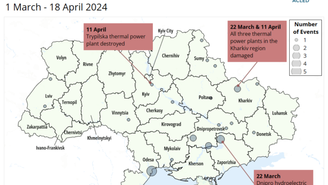
Russia has exploited Ukrainian ammunition shortages due to the six-month delay in the approval of US military aid, sluggish deliveries…

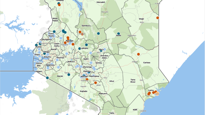
Situation Update | April 2024 Kenya: Kenyan Security Forces Combating al-Shabaab, Pastoralist Militias, and Mob Violence 19 April 2024 <…

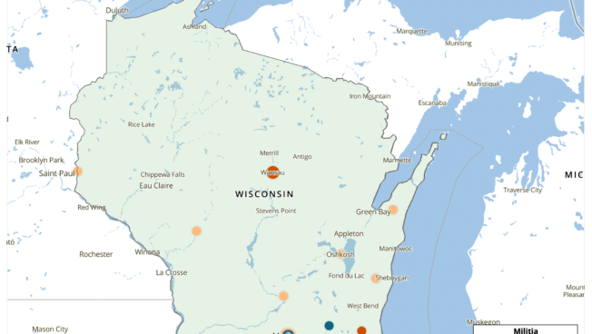
Michigan, Pennsylvania, and Wisconsin are vital swing states for securing the presidency in the 2024 election. These three states, however,…

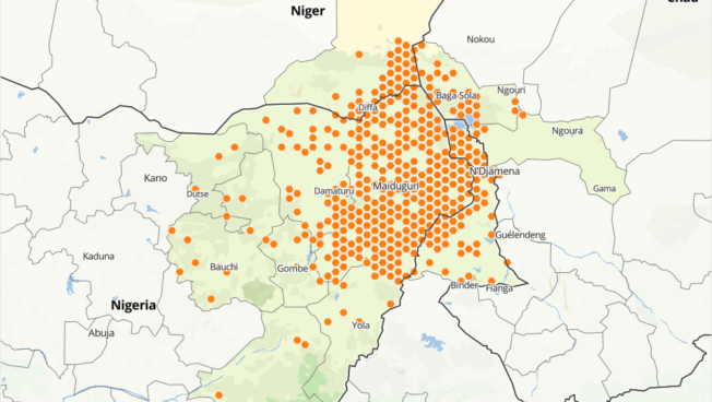
Boko Haram remains an active insurgent group in the Lake Chad area of Nigeria, Cameroon, Chad, and Niger amid regional…

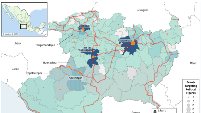
In Mexico’s Guanajuato, Guerrero, and Michoacán states, violence targeting political figures generally occurs in hotspots of gang disputes. Past municipal…

In ACLED’s new Conflict Watchlist, we identify 10 crisis areas that are likely to evolve in the coming year. The Watchlist goes beyond a snapshot of violent hotspots; these local, national, and transnational conflicts represent some of the most complex crises in the world.
As the war in Gaza continues to rage, check our hub page for the latest ACLED resources, data, and analysis on political violence in Israel and Palestine.
")
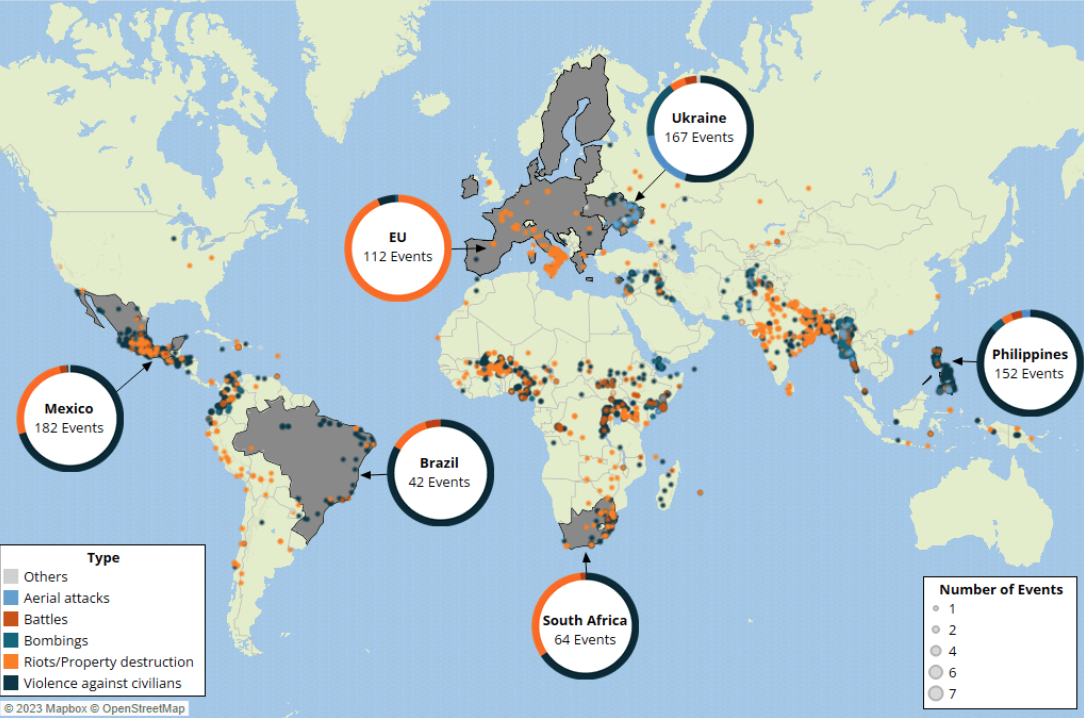
Our inaugural special issue examines trends in violence targeting local officials in the European Union, Ukraine, Mexico, Brazil, the Philippines, and South Africa.
Sign up for the ACLED newsletter to get the latest updates delivered straight to your inbox.
Our monthly analysis briefs break down the latest data on political violence and protest trends, highlighting potential early warning signs for closer monitoring. Select a region from the list below to see the latest regional overview.

")


The Ethiopia Peace Observatory (EPO) is a special project launched by ACLED to enhance local data collection across Ethiopia. The EPO aims to provide a dedicated platform for governments, media, civil society, and the public to access reliable information and analysis about political violence and unrest across the country.

Cabo Ligado (‘connected cape’) is a conflict observatory established by ACLED in partnership with Zitamar News and MediaFax to monitor political violence in Mozambique. The project supports real-time data collection on the insurgency in the country’s northern Cabo Delgado province and provides cutting-edge analysis of the latest conflict trends.